Showing posts with label Ride Report. Show all posts

Sunday, May 4, 2014

Early Season Ride up to Hatcher Pass

When I was a child, my family lived in Northern Japan. One of our frequent day trips was to drive to the Towada Mountains, a volcanic range of mountains, one of which had a caldera lake, with an absolutely spectacular gorge carved by the Oirase River which flowed from the lake to the ocean below and to the east. To this day, it's one of my favorite places on earth; perhaps my very favorite, even. I remember traveling up into the mountains near the caldera lake one winter afternoon, and being amazed. The snowplows had done an amazing job of keeping the road clear -- but on either side of the road were vertical walls of snow towering way over our heads. It was an impressive sight, to say the least.

So, when a co-worker told me he had recently tried to drive over Hatcher Pass between Willow and Palmer, Alaska, and had run into walls of snow that sounded like the ones from my childhood in Japan, I decided I needed to take a trip out to Hatcher Pass to see it (again) for myself.


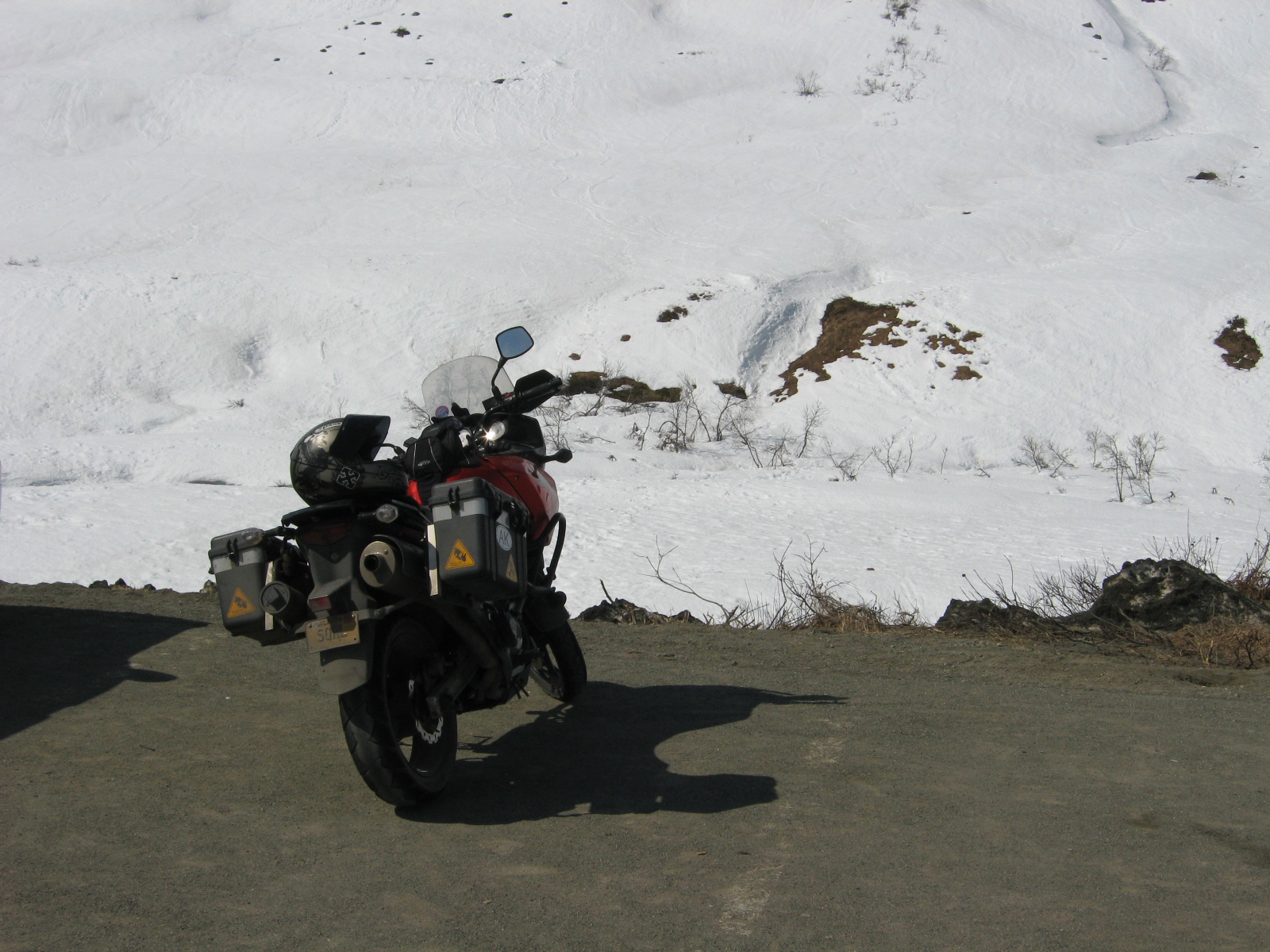
My co-worker had driven up from the Willow side, and maybe the Palmer side was just a little warmer and received a little more sun than the Willow side. Or maybe, I just waited too long to head out to the Pass. Whatever the reason, I didn't find ten-foot-high walls of snow on either side of the road, but it was a great day for a ride, anyway. The weather was beautiful -- warm, sunny, mild winds -- and the trees were just starting to bud, filling the air with the delicious aroma of spring (cottonwoods are a pain in the backside come mid-summer, but they smell wonderful in early May!). Even though the snow wasn't as high on the sides of the road as I expected, there was still too much snow near the summit for either the Pass itself or Archangel Valley to be opened yet...which is not at all unexpected, as the Pass usually doesn't open until around the 4th of July. Nevertheless, if you are visiting Alaska by motorcycle (or even by car), I'd still recommend a trip up to Hatcher Pass, if you find yourself in the Mat-Su Valley. Like the Towada Range in Japan, it's one of my favorite places to spend a sunny summer day.

Sunday, October 27, 2013

Al-Can 2013

"Beginnings are a very delicate time..." --Princess Irulan, "Dune" (by Frank Herbert)

"Every new beginning comes from some other beginning's end." --Closing Time, Semisonic

It was a bright, sunshiny day in May of 1988 when I stood outside Meade Senior High School with three of my best friends, Dave Pettyjohn, Lee McShane and Mark Perry, congratulating and high-fiving each other. Our commencement ceremony had just ended; the four of us were officially high school graduates. As we stood there in the sun, broad grins splitting our faces, I felt like the entire world was just waiting for me to reach out and take it. From the end of my high school tenure was birthed a whole new beginning, and I could make of this new beginning anything I wanted. Both my mood and my future, just like the weather that day, was bright and full of promise.

I am not exactly sure what caused this particular memory to surface as I turned north out of Glenallen, Alaska en route to Seattle, but I couldn't deny the appropriateness of it. Just as I had felt on my graduation day, I was filled with a sense that the world was waiting for me to make of it what I willed. I was leaving Alaska for close to a month, and the thin ribbon of asphalt stretching away into the rolling hills outside of Glenallen seduced me out of my beloved Alaska, promising new adventures once I crossed the Canadian border.

The plan had hatched just a few short months earlier. My step-daughter had been working on a Physician's Assistant certificate through the University of Washington, and she needed help watching her son Clark while she was there. Through some combination of miracles and divine intervention, I not only got my wife to agree to drive a motorhome down the Al-Can while I followed along on my motorcycle, but my wife and I also managed to convince our respective bosses to give us a little over three weeks of leave in which to make the trip. Now, after months of planning, the departure date had arrived, and we were off!

The first day was largely uneventful, although we left Anchorage about two hours behind schedule. As we hit the Glenn Highway, I chuckled as I realized I had the theme song from "Smokey and the Bandit" on my mind:
  East bound and down,
  Loaded up and truckin'.
  We gon' do what they said can't be done.
  We've got a long way to go,
  And a short time to get there...


How appropriate! I mused to myself.

The weather was clear, warm, and sunny, and the V-Strom performed flawlessly. The highway between Tok and the Canadian border meanders through valleys in a number of mountain ranges, and I was mesmerized by the scenery. Having grown up near the volcanic Towada Mountains in northern Honshu, Japan, I love the mountains, and never, ever tire of their beauty. However, the Alaska Department of Transportation has been busy maintaining the roads near Tok this year, and, much as I wanted to sightsee, I found that I had better keep my eyes on the road, as the asphalt was intermittently marred by swatches of gravel where the road crews were busy re-paving stretches of highway. One particular swatch of gravel felt unusually tricky, forcing me to throttle back to about 40-45 MPH. At a rest break a little ways up the road, my wife mentioned that the gravel in that particular section was soft, and about 2 to 3 inches deep. Oh...that explains a lot! Both motorcycle and RV survived the road construction, however, and after approximately nine hours and 430 miles, we crossed the Canadian border -- my first border crossing by motorcycle, and another item ticked off the motorcycling bucket list! -- and rolled into Beaver Creek, Yukon, where I was greatly surprised by the number and ferocity of mosquitoes. Having lived in Alaska since my first trip up the Al-Can in 1989, I am no stranger to mosquitoes, but I have never encountered more numerous nor more persistent mosquitoes than those that welcomed us to the Yukon.

The First Nations border guard was polite and friendly: "You're with them?" pointing to the RV ahead, containing my wife and twelve year old daughter.

"Yes, sir."

"Usually when I see a motorcycle carrying that much gear..." with a nod at the tent, sleeping bag and mattress pad strapped to the passenger seat of my bike, "...they aren't traveling with an RV."

"Once we reach Seattle, I am planning to take a couple of days and continue solo to Crater Lake, Oregon before returning back to Alaska with my family."

A nod. "Ah. Can you remove your helmet, please?"

Oh...yeah. I am wearing a helmet, aren't I? "Sure, sorry. Forgot I had it on."

"Thank you. Have a nice day."

Wednesday morning dawned clear, hot and sunny, just as the previous day had been. When I first drove the Al-Can in 1989, I remember being amazed and somewhat ashamed that the roads in the Yukon seemed to be so much better quality than the roads in Alaska. While there were long stretches of gravel in the Yukon, the paved sections were smooth, seamless, flawless asphalt, whereas the roads on the Alaska side of the border were patched and frost heaved. Not so this trip. Words fail me when I try to describe the asphalt we encountered near Beaver Creek. It wasn't pot-holed or frost heaved; it was something else. It was as if a giant child had dragged his fingers in the asphalt while it was still hot, leaving meandering grooves and ridges a foot wide and tens of feet long in the asphalt. I stood on my pegs and picked the smoothest path I could find; my wife did likewise, but in a 26 foot RV with a ten foot utility trailer behind, it was impossible for her to avoid all the ruts. Eventually, the bouncing and jostling collapsed the legs on the Weber grill that I had strapped down on the utility trailer, rendering it inoperative for the rest of the trip >:( Other than the poor roads, the ride was uneventful until we reached Kluane Lake, where I stopped to shoot a couple of photographs:


After Kluane Lake, we started skirting rain showers, getting sprinkled on a few times, but riding mostly in good weather. We stopped at an absolutely phenomenal pizza joint in Whitehorse for dinner, where I discovered how important it is to perform a pre-ride inspection, just like I used to do when flying airplanes. It was getting late, I was a bit fatigued, and after removing and stowing the carbon fiber side-stand plate that I use whenever I park on gravel, as well as the "Remove Before Flight" reminder flag for the brand new disk brake lock I had purchased for this trip, I fired up the engine, put the bike and gear, slowly let out the clutch and...stalled the engine. Wash, rinse, and repeat several times. I had the sinking feeling that I had a serious transmission problem. No matter how gently I feathered the clutch, the bike stalled with an ugly "thunk" sound. I called to my wife that I had a transmission problem, to which she sweetly replied, "Did you remove the disk brake lock?"

&©%#!!!

Fortunately, the flush that covered my face was obscured by my helmet. "Ummm, no...I removed the, ah, reminder flag, but not, umm, the lock itself..." I mumbled. You see, I had cut the cord for the reminder flag about six inches too short to reach from the handlebars to the disk brake, so although I had remembered to remove the flag, I had forgotten to remove the object it was supposed to remind me of, namely, the disk brake lock itself. Feeling like a fool, I sheepishly removed the lock, kicked off Google Navigator on my cell phone (securely mounted on my handlebars) and...promptly took a wrong turn, resulting in a three mile detour through a residential area in Whitehorse. Finally, we found the Al-Can again, and raced off into darkening skies and increasingly strong winds. As we approached Marsh Lake, I pulled into a rest stop to don my rain gear before I got totally soaked, and sure enough, within half a mile...the rain stopped. We finally called it a night in Teslin, after a mere 383 miles taking almost nine hours on the road.

By the time we arrived, my low fuel light was flashing desperately for my attention, and I was beginning to wonder if I would be pushing the bike the last few miles. Pro-tip: when stopping for dinner in Whitehorse, make sure you take the time to fill your gas tank! A 'Strom has sufficient range to make it from Haines Junction to Teslin, but just barely.

Day three began with a hearty ham-and-egg sandwich and a decent cup of coffee at the Yukon Motel (and RV park) restaurant under, once again, clear, warm and sunny skies. I was a little nervous about today's ride, however, as the bridge just south of town is a steel grate bridge, and I have read a sufficient number of accounts of motorcyclists who had been unnerved by crossing such bridges on a bike. I would be crossing the bridge -- my first steel grate bridge on a bike -- with a full load of fuel in my 5.8 gallon gas tank, on a bike that is already top heavy, even without a full load of fuel. I topped off the tank anyway, gritted my teeth, and set off apprehensively. As I rolled onto the steel grate, I was pleasantly surprised by the bridge. Signs warned motorcyclists to "Use Extreme Caution!!!" (as if a motorcyclist should ever *NOT* use extreme caution on the road!), and prophecies of doom from countless other ride reports echoed in my head, but in all honesty, I found the steel grate bridge to be no worse than a gravel road, and in fact, arguably easier to ride than some gravel roads I've followed (Palmer Creek Road, I'm talking about you!). Yeah, it's a little squirrely, but not at all bad. If you can survive the construction to reach one of the several steel grate bridges you'll encounter on the Al-Can, you'll be fine. Just stand on the pegs, relax and let the bike wriggle under you; you'll be fine, I promise! :)

A few hours later, I found myself in a light rain again. We were only about twenty minutes outside of Watson Lake, and remembering how the rain had ended as soon as I put on my rain suit the day before, I decided to press on towards Watson Lake. For the next ten minutes, the rain steadily grew worse, until finally, beginning to be a bit chilled by the cool air, and worried that I wouldn't be able to maintain body heat if my leathers soaked through, I pulled over at a pull-out and donned the rain suit again. Five minutes later...no rain. Sigh.


Day three was a short day, just over six hours of riding time, because our destination for the night was Liard Hot Springs, and we wanted to make sure we had enough time to enjoy the springs. After three days of riding, soaking in the hot water at Liard was incredible. We stayed in the springs until sundown, then reluctantly dragged ourselves out of the warm, relaxing embrace of the water and back to the RV for the night. I set my alarm for early the next morning to sneak back to the springs while everyone else was still asleep...

...but woke to the pitter-patter of rain drops on the roof. Cold, even snuggled under a blanket in the RV, I could not bring myself to don my clammy swim shorts and hike the half mile(-ish) back to the springs in the rain, so I slept in for another two hours. Evidently, the soporific properties of the hot springs affected my wife and daughter as well, because it was yet another two hours before they awoke. As they slowly clambered out of bed, I put on my riding gear and rain suit, then went outside to prepare for departure. My wife and I man-handled the utility trailer back onto the hitch of the RV, as the jack was not tall enough to lift the tongue over the hitch at the odd angle of the parking pad. Finally, the trailer was hitched, and I turned to finish getting the bike ready to go as my wife pulled out of the camp site in the RV.

I whirled back around as I heard an odd grating sound from the RV, discovering, to my horror, that we had neglected to raise the jack on the trailer. My wife had no idea that she was digging a furrow with the trailer as she drove out of our campsite and onto the road. I raced up near the passenger window -- no easy feat in full leathers and shin-high motorcycle boots -- and she started to slow down. I ran towards the back of the trailer to raise the jack when she started driving again. I slapped the side of the RV hard enough to leave a bruise on my palm to get her attention, and finally, she stopped.

By this point, the damage was done. The jack had kinked, preventing us from raising it, so I set to work with a socket set that I fortunately had had enough foresight to bring. Unfortunately, the kink was severe enough that I couldn't lift the jack through the tongue of the trailer, and we were blocking the road out of the campground. "Please, don't let another camper come through here until we have this fixed," I thought to myself...just as another camper came around the corner behind us.

The campers were a father and son from British Columbia, who were gentlemen in every sense of the word. "I work for a trucking company, and I see guys forget to raise the jack all the time," the son graciously stated. The father retrieved an axe from the car and tried to straighten the jack with the blunt end of the axe, but it wouldn't budge. Finally, after several false starts, we set the jack on the ground, and the father began hitting the tongue of the trailer, trying to force the kinked jack through the tongue. At last, we succeeded, but we had set the jack on the trailer wiring, slicing the ground wire in two.

"Sorry about that. I've got some wire strippers and electrical tape in the car," the father said.

I just laughed, shrugging his entirely unnecessary apology off. "If I hadn't forgotten to raise the jack, none of this would be an issue. I'm not at all worried about the wires."

We stripped the ends of the wires, twisted them together, wrapped them with electrical tape, and all was good. Blinkers worked, brake lights worked, and so thanking the two once again for their help, we set off down the highway in the rain.

A short time later, we stopped to refuel at an exceptionally nice lodge on the shores of Muncho Lake. As I topped off the tanks, I briefly reconsidered my decision to ride despite the rain and cold. We had the ability to trailer the bike, but I really wanted to ride all the way to Seattle, so I turned up the power on the heated grips a notch, and pointed the Strom eastward again.

Five minutes later, concerns about the weather were the last thing on my mind. I chuckled to myself as I grabbed a fistful of throttle at yet another "60kph" advisory hairpin turn overlooking Muncho Lake. I found that I could easily maintain the advisory speed limit -- in miles per hour, rather than the posted kilometers per hour.

Despite the rain, I was having the time of my life. The road itself was pure joy, dancing around the natural contours of the lake and the mountainside that rose from the shore, and Muncho Lake itself was stunning, with a blue-green tint unlike any other lake I have ever seen. I found myself imagining I was back in northern Japan, where I spent most of my adolescent and pre-teen years; the shoreline vaguely resembled stretches of the coast of Honshu near Aomori -- to this day, one of my favorite places on earth.

For 30 miles or so, the road weaved and twisted back upon itself, slowly, imperceptibly, gaining elevation, as the temperature, just as imperceptibly, dropped. Finally, having left the bliss of Muncho Lake Provincial Park far behind, I found myself entering Stone Mountain Provincial Park, and I realized with a start that I was thoroughly chilled to the bone, despite my wool base layer, full leathers, rain suit over the leathers and heated grips. My ankles and wrists were growing stiff with the cold, and I was no longer enjoying the ride. I began searching for a pull-out where I could flag my wife down and heat some water for coffee or tea to restore my core body temperature. Finally, near the summit, I spied a rest stop, and steered the Strom off the side of the road. Looking around, I realized that the parking area I had pulled into might be difficult for her to drive out of again, since she was maneuvering a 26 foot RV and pulling a ten foot utility trailer. Fortunately, on the other side of the road was a large, open, paved lot that she could easily fit into. I turned on my four-way flashers, then pointed her to the lot across the road as approached.

She didn't stop.

Furious -- and bordering on the early stages of hypothermia -- I punched the hazard light switch, stomped on the shift lever to drop into first gear, savagely wrenched the throttle to WFO and rocketed off down the road after my family. We continued down the highway, me fuming, my wife blissfully unaware, until we reached Fort Nelson. After making up, and establishing a better method of communicating in areas without cellular coverage :) (she thought I was waving her past, rather than pointing her to a better place to stop), we continued on to Fort St. John, firmly convinced that both the more southerly latitude and lower elevation meant that the worst was behind us.

Silly, silly me.

Watching both the gas gauge and the GPS slowly unwind, I foolishly decided not to fuel up as we drove past Sikanni Chief campground, the only fuel stop I knew of between Ft. Nelson and Ft. St. John. A few miles down the road, I began to realize that I would be running on empty by the time we arrived; strong enough headwinds or steep enough hills, of which there are plenty on this stretch of road, could mean the difference between riding into town or pushing the bike. We had five gallons of extra gas on the trailer, but I didn't know how much range the RV had, nor how much gas my wife still had in her tank, so I began searching in earnest for gas stations.

I finally found one on a hill, overlooking a set of ominous looking clouds giving birth to a gorgeous, intense rainbow. Unfortunately, the gas station was closed...as was the next one, and the one after that. Finally, we found an open gas station at Pink Mountain RV park. After topping off both vehicles, my wife asked if I minded if she started out while I went inside to pay. I agreed, since it was easy enough for me to catch up to her. In fact, I frequently found myself slowing to wait for her when the road grew either twisty or hilly, as the RV simply couldn't pace the bike on such roads. I had a good laugh when the poor cashier in the service station did a double take at the motorcyclist buying roughly twenty gallons of gasoline ("Yes, my motorcycle has long-range tanks," I teased, before explaining that I was also paying for the gas in my wife's RV). Finally, I raced off after my wife, hoping to catch up with her soon, as I really didn't like the look of the dissipating thunderstorm to the east. I soon found myself hunched over the gas tank, as the miles quickly ticked off on the odometer.

I didn't realize it in the growing dusk, but the dark visor on my helmet was becoming increasingly obscured by the spray kicked up from the traffic ahead of me. Finally, I noticed an odd looking patch of road ahead. "Is that concrete?" I wondered. "Are they doing construction here?" Then I realized the magnitude of my error. Not concrete, rather the road was coated with a sheet of hail that had melted and compacted to form rime ice.

Did I mention that I was riding at...ummm...perhaps a slightly higher speed than was wise on wet roads, near dusk, in the vicinity of a thundertorm? Okay, maybe I was riding at a pace that would have been, ahem, brisk even under perfect weather conditions.

The bike did a little dance underneath me, slid off of the ice into the ruts that four-wheeled traffic had carved in the ice, then regained its composure and continued down the road as if nothing had happened. Needless to say, I slacked off the pace a bit (okay, a lot!), and caught up with my wife around the next bend. I flashed her a thumb's up as I passed her at a very sedate, very conservative 45 MPH, and we continued on -- slowly -- until a very long, very tiring, very stressful day four ended roughly an hour later in a crowded RV park in Charlie Lake, just outside of Ft. St. John.

For the second day in a row, I awoke to the tick-tick-ticking of rain on the ceiling of the RV. As I got dressed and sucked down a cup of instant coffee, the rain slackened off, then quit entirely. Nonetheless, remembering the cold, miserable ride of the day before, I pulled the rain gear over my leathers as we headed west out of Charlie Lake towards Chetwynd. Just a few miles out of Charlie Lake, we entered some of the steepest grades of the trip, as the highway wove around the mountains near the Fraser River. I wondered about the story behind a multitude of signs protesting a proposed dam; I wasn't certain, but if I understood some of the signs correctly, the dam would (or at least could) result in many of the farms becoming submerged under ten to fifteen feet of water. I silently wished the farmers luck in their battle to save their homes, and continued on my way.

After several hours, and gas stops at numerous small Canadian towns -- including one stop where I dropped my helmet and broke the clear visor >:( -- we pulled into the outskirts of Quesnel, where we stopped for the night at 10 Mile Lake Provincial Park, one of my favorite stops of the trip. After spending three out of the four nights so far on the road in RV parks, the quiet and peace of the Canadian Provincial park on night five was a nice change of pace.

Before leaving Anchorage, I had spent quite a while on Google Maps and the Alaska Milepost trying to plot the route for the last leg. However, I was a little confused by the route near Cache Creek. The course I ended up plotting turned off of 97 shortly before reaching Cache Creek, and followed 99 to Lillooet, then turned onto 12 until reaching Lytton. When we reached the intersection of 97 and 99, I pulled over to discuss the route with my wife, and we decided that this was indeed the route we wanted to take. From the comfort of my sofa two months later, I can honestly say that I am very glad we followed this route. This was, by far, the highlight of the whole trip. CA-99 wound and twisted as it followed a mountain valley, slowly increasing in elevation. From the vegetation, I could tell we were entering a more arid part of Canada, even though a gorgeous river twisted through the valley floor next to the highway. Soon, the valley floor widened, as did the river, emptying into a long, narrow, sinuous lake. It was all I could do to keep my eyes on the road, entranced by the beauty of the valley. Before long, lake became river once again, and the road, already as much fun as a motorcyclist could hope for began to tie itself in knots. My speed dropped from 55 MPH to 35 MPH, and the grin I wore threatened to split my face in two. The highway climbed into the mountains like an asphalt serpent, coiling back upon itself. I soon found myself behind a BMW GS, two-up and loaded with gear. They were traveling a little slower than I would have been, but honestly -- and surprisingly -- I didn't care. I was so enthralled with the high desert beauty around me, that for once in my life, I didn't want to race at top speed.

I was in motorcycle heaven.

Finally, spying a pull-out over an exceptionally beautiful point high above the river, I stopped to snap a couple of photos:


Soon enough, it was time to leave, and after taking one wrong turn (the route didn't actually pass through Lillooet, but rather continues past the turn-off, on the opposite side of the river from town), we continued on to Lytton. CA-12 to Lytton, however, climbed up into the mountains, and very obviously didn't see much traffic. At one point, the road narrowed to a single lane over a steep cliff with no guard rails between the asphalt and the drop-off. It wasn't a problem for me on the bike, but caused my wife in the RV some concern when she encountered a Jeep Grand Cherokee coming the other way (she nicknamed the road "the donkey trail," in reference to the narrow, winding trails descending into the Grand Canyon).

By approximately 5:00 p.m., we stopped for gas in Lytton, and my wife pulled out the travel plan I had created before leaving.

"Mike! Do you realize we still have five hours to Seattle?!?!"

We had already been on the road for six hours, not including a lunch stop, and thought we were no more than an hour or two from our destination for the day. I double checked the trip plan, Google Maps, and the Alaska Milepost, and finally decided that she was right. We were a lot farther from our night's stop than we thought. We hastily departed the gas station in Lytton, and raced towards Abbottsford, B.C., hoping to make up as much time as possible, since the scenic route past Lillooet had cost us a lot of time. We barely noticed the stunning scenery between Lytton and Abbottsford. Boston Bar, Yale, Hope...all of the little towns along the Fraser River passed in a blur, as we raced the setting sun to Seattle.

Reaching Abbottsford, I turned south a little earlier than I intended, crossing the border into Washington at Sumas. Unlike his counterpart at Beaver Creek, the American CBP official was curt, direct and assertive almost to the point of being rude, until the end of the interview.

"So you're with the RV behind you?"

"Yes, sir."

"Why not just trailer the bike and ride with them?"

"I've flown the Al-Can in small airplanes three times, and I've driven it in a car another three times, but I've never ridden it on a bike before," I answered, once again at a bit of a loss to explain why I, like most motorcyclists I know, do what we do.

"And...?"

I shrugged. "Ummm...that's it..."

A broad grin split the CBP agent's face.

"No, how was it?"

I laughed, spying the KLR 650 parked near his booth, and finally catching his drift. "It was awesome," I gushed.

He waved me through with a huge smile, vicariously enjoying the trip seemingly as much as I had. "Have a good one!"

I relaxed, oddly comforted to be back in the U.S. again...until I checked my GPS. It was getting late, almost eight o'clock, and the sun would be setting soon. As I mentioned earlier, I had broken my clear visor in Canada, and was riding with my dark, tinted visor on the helmet. Sunset would be soon, and we still had an hour and a half, maybe even two hours, until we reached Seattle, and even then, we still had to find the RV park where we would be staying. My wife and I wound through the farmlands of Sumas and the surrounding communities, until finally reaching I-5. A half hour later, I watched the sun set over the western horizon, and realized that I would be riding in the dark with my tinted visor, despite my best efforts to reach Seattle before sunset. My step-daughter started school the next morning, so we had to be in Seattle tonight -- stopping short wasn't an option -- so, I gritted my teeth and pressed on in the dark.

Tired, stressed, and unable to see much other than headlights of the vehicles around me, my wife and I raced down I-5 at speeds I'd rather not confess in print, my motorcycle so close to the bumper of the trailer that I knew I'd never stop in time if she slammed on the brakes. However, I didn't dare increase the following distance between us, as my wife had the turn-by-turn directions printed on a sheet of paper in the RV (I thought -- it turns out they had blown out of my daughter's open window before we crossed the border into Washington). Eventually, my wife called my cell phone (plumbed into my helmet with BlueTooth), where I discovered that I couldn't navigate with GPS while on a phone call, as my GPS was Google Navigator on my phone, and the phone call took over the screen. We agreed that I would take the lead, and we would only call when absolutely necessary so that I could still navigate.

The last hour into Seattle is best forgotten. I have never been so anxious to get off a motorcycle. Unable to see in the dark, in an unfamiliar town, following GPS directions to an RV park I have never visited, riding in more traffic than we ever see in Alaska, and exhausted by over thirteen hours on the bike -- when we only expected to spend eight -- we finally pulled into the RV park at 10:30 Sunday night.

My wife, who truthfully does an exceptional job driving the RV, hates to back into parking spaces, and simply refuses to do so when pulling a trailer. As good as she is driving large vehicles, my wife's brain cannot make sense of the way a trailer reacts to steering inputs, so backing a trailer into a parking spot is my job. However, by the time we reached the RV park, I was so fried, I couldn't hardly figure out how to work the latches on my motorcycle boots. Fortunately, the husband of the RV park owner, one of the friendliest and most helpful men I have ever met, walked me through parking the RV and trailer in our spot. Without him, I think I would have simply nosed into the spot. No joke. And with that, after six days on the road, we finally reached Seattle.


Entire photo gallery from this trip here.

Monday, July 9, 2012

Hatcher Pass

Back when I was lusting over a Triump Street Triple R, one of the things that swayed me away from a superbike and into a V-Strom was imagining the kind of riding I'd really like to do. The S3R was a sexy bike, no doubt about that, but when I was really honest with myself, I knew that the Triumph wasn't engineered with Alaska's frost heaves and gravel roads in mind. Now, 14,000 miles (and change) later, I am more convinced than ever that the Wee-Strom was a much better bike for me than the Triumph (although I still want to own an S3R...eventually :)

One of the trips that I wanted to make that helped steer me away from the Triumph was a trip over Hatcher's Pass, near Palmer. The beginning of the ride on the Palmer side of the Pass follows the Little Susitna River, a shallow, splashy creek that meanders through the valleys in the foothills of the Talkeetna Mountains. The Triple would be loads of fun here, as the road follows the curves that the creek has carved in the bedrock of the Talkeetnas. However, there is much more to Hatcher's Pass than the few miles of twisties along the Little Su. In fact, most of the road over Hatcher's Pass is gravel 1 1/2 lane. I had never driven the pass all the way through from Palmer to Willow, but I wanted to, very badly. Once I started motorcycling, I knew I had to ride this route on a bike. Unfortunately, a naked supersport is hardly the ideal steed for such a ride, and so this helped me decide upon the V-Strom, an ideal bike for both the paved twisty sections near the Little Su and the gravel stretch over the top of the pass.

Yesterday morning, July 8th, dawned bright and clear, although still rather chilly, even by Anchorage standards. Nevertheless, I donned my riding leathers -- no Kevlar-lined denim on this trip; I wanted full CE-approved armor for the exploring I had in mind -- and hit the road around 10:00. By eleven, I was huddled next to the fireplace at the Starbuck's in Palmer, sipping on a mocha and reading a couple of chapters from Ghost Rider by Rush drummer and ADV motorcyclist Neil Peart (a good read, though understandably melancholy at times) as I tried to warm up. About a half hour later, I was back on the road, and soon I was in the aforementioned twisties, behind a Subaru wagon, which was actually sustaining a much better pace through the curves than one might imagine.

As we approached the hairpin turn that signalled the road's departure from the Little Su, I greatly increased the spacing between myself and the Subaru. While the driver had done a surprisingly acceptable job so far, we were approaching the tightest turn on the road, and I wanted to have enough breathing room to enjoy it. The Subaru slowed, turned, and accelerated up the straightaway on the far side of the curve, and moments later, I followed, leaning the bike to the left, hanging off the side, knee out...and what is that rumbling I feel in my left foot? What is that horrid scraping noise? Did I just...uh...yep, I think I did. I've touched my toes to the pavement a couple of times when heeling the bike over hard on a sharp turn, but was the first time I had ever dragged a footpeg...at least on my Strom. I had dragged the pegs on my wife's S40 Boulevard and I had even dragged a peg during my MSF course, eliciting a thumbs-up and a smile from the ex-racer riding coach, but my V-Strom has much greater ground clearance than either of those bikes. I barely had time to crack a smile at (finally!) touching a footpeg on the turn when I reached a side road I wanted to ride.

Shortly before earning my motorcycle endorsement, I discovered another road for which the S3R is even less suited. Wa-a-a-ay back when my Nissan Frontier was just barely broken in, my two brothers and I packed up our backpacks and set out in my truck for an overnight hiking/camping trip in Archangel Valley. While it was a fun trip, at least for the two of us in the front seat (sorry, Nick!), I started daydreaming about returning to Archangel Valley on a bike. I thought that it would be even more fun on the Wee than it had been in my pickup.

I had no idea :)

The road itself is a narrow, rocky, pot-holed, winding trail that leads from the main road in Hatcher's Pass up to an old, abandoned mine. Rusty mining equipment and old mine shafts with beard-like tailings cascading down the mountain sides give mute testimony to Hatcher Pass's rich (in either sense of the word) history. However, today, hiking and exploring the mines was not foremost on my mind -- far from it. I was here to ride, and ride I did.

The road itself was relatively dry, although the bottoms of most of the potholes were filled with mud puddles. I splashed my way over, around and through the puddles, dodging the deeper, steeper holes, and weaving around the larger boulders that stabbed through the packed surface of the dirt road. Even with a nearly bald rear tire, I was able to comfortably maintain between 25 and 35 MPH...until I caught up with a 4x4 pickup picking his way through the minefield of granite and mud at more like 5-10 MPH. I paced him for awhile until we reached a slightly wider part of the road and he waved me past. Soon, I caught up with another 4x4, and then another. Wash, rinse, repeat.

I was picking my way around another mud puddle when I noticed something in the road. That's odd, I thought to myself. It looks like something peed on the road, but what pees BLACK? That's when I realized someone was having -- or was about to have -- a VERY bad day:


That wasn't pee -- it was motor oil. Someone had bottomed out, but they hadn't had the ground clearance to avoid a rock, and they had punctured the oil pan. I raced up the road, hoping that I could catch the victim before they seized their engine. A short distance later, I saw a VW Jetta picking it's way over the road, and sure enough, the oil trail marked it's passage around the obstacles on the road. Catching up to it, I could see the oil draining from underneath the car. I honked, saw the driver look up in his rear-view mirror and pulled up beside him.

"Dude, you're leaking oil from under your car. Did you bottom out a little ways back?" I asked.

"Yeah, but I didn't think I hit that hard," he replied. He pulled over, shut off the engine and looked underneath the car. He muttered a few choice words under his breath. "How am I going to get back out of here?" he wondered aloud. About that time, a truck that had just passed going the other way stopped, and the driver walked back up to where we were. The driver of the truck, the driver of the Jetta, and the passenger in the Jetta chatted for a few minutes, then the guy from the truck offered to give the two from the Jetta a lift back to Palmer where they could call for help. I continued on up the road after loosening the pre-load on my rear shock one full turn and letting about 5 PSI out of my tires -- something I should have done as soon as I left the pavement.

The rest of the ride up and back out of Archangel Valley was uneventful, but arguably the most fun I've ever had on my V-Strom -- and certainly the most fun I've had since last year's Denali Highway trip. By the time I reached the main road going over the pass, I was sweating and my back was mildly sore from stooping over to reach the handlebars while standing on the footpegs. I didn't care; inside my helmet, I was wearing a grin a mile wide.

After leaving Archangel Valley, I continued up to the summit of the pass, beyond Independence Mine, the farthest point I had ever gone. I didn't realize how close to the summit the mine was, so I was very surprised to reach Summit Lake within just a couple of minutes.
Yes, the date was really July 8th, and yes, there was still ice in Summit Lake. We received a record snowfall in Anchorage last winter, and while the rest of the country has posted record high temperatures, the summer so far in south-central Alaska has been unusually cool. I can count on one hand the number of days that I've had the insulated liner out of my jacket. I've ridden most days with my insulated gloves rather than my summer gloves so far. I've even had the heated grips on more often than not this year. Therefore, I wasn't surprised to see ice in the lake.

A short ways down the pass from the summit, I saw an interesting looking side road, and decided to see where it lead. Similar to Archangel Valley, this unnamed road (Google Maps suggests that it's Upper Willow Road, but it wasn't marked) was a narrow, rocky, winding road through what appears to be a glacial valley. This road, however, does not see the same traffic as Archangel Valley, and the rocks along the route are larger and looser than the road I rode earlier, and the road itself is narrower. I had a blast...until I caught a face full of tiny black flies while my visor was up, lol. The air blowing through my helmet was refreshing. The bugs blowing through my helmet, however...not so much.

This road is also shorter than the road into Archangel Valley, so I soon reached the end, and reversed course to rejoin the main road down the pass into Willow. Even though the road was in pretty good shape and wide enough for two cars to pass side by side (albeit, slowly), I found I was still riding at a, ahem, somewhat "accelerated" pace compared to the cagers around me. Many of them would pull to the right and wave me around them as I would catch up, a couple of them I passed when I saw a likely opportunity without waiting for a signal to pass.

Incidentally, if the guy in the cool, yellow, vintage LandCruiser happens to find this post, I apologize for revving my engine as I passed you. It wasn't intentional; my motorcycle dropped out of second gear and into neutral as I rolled on the throttle, an annoying bad habit it has recently acquired. On the other hand, to the dude in the Chevy pickup, weaving all over the road while holding a pocket-sized video camera to your head -- I sincerely hope the life you eventually end up taking doesn't belong to an innocent driver coming the other way, or to a passenger in your rig (hint, hint).

Finally, nearing the bottom of the pass on the Willow side, I encountered a broad, open vista spanning as far as I could see around me. I pulled off on the side of the road, retrieved my camera, looked through the viewfinder...and put it away. Just like on the Denali last year, I realized that such grandeur requires a far larger format than my Canon Powershot. There is no way to catch beauty on such a scale in a digital image; once again, I would have to be content with memories. Hmmm...maybe I just need to make another trip up the pass with my wife and daughter soon? :)

Monday, April 30, 2012

Spring Shakedown Ride

There's a joke in the corner of the country where I live: "What do you call two days of cold, windy rain that follow immediately after five days of warm, beautiful sunshine? A weekend." All last week, I would get up in the morning, put on my motorcycle gear and commute to work, just barely resisting the temptation to call my boss en route and tell him that I wouldn't be in today. He would understand; he rides, too.

Last Thursday was the worst. My daughter had a field trip to Kenai, and I had the day off so that I could help chaperone her trip. We left Anchorage at 6:00 a.m., driving along the scenic Turnagain Highway into the mountains on the Kenai Peninsula. I had considered taking the Wee since I was going to be driving my own vehicle, and Kylie (my daughter) wanted to ride the bus with her friends. The Wee gets much better gas mileage than my Nissan truck, so the bike would be a lot less expensive to ride on the 300 mile round trip. However, the temperatures on my ride to work in the morning had been in the mid to upper 30's (F), so I was concerned about being too cold on the way to Kenai, since we would be leaving even earlier and would be riding through the mountains. Furthermore, I had been through Turnagain Pass yet this season, so I didn't even know if the pass was ice-free yet. Consequently, I wimped out and took the truck. Needless to say, it was a picture perfect day -- not a cloud in sight, and I spent the entire day in the truck wishing I was on the bike, although that's arguably better than being on the bike, wishing I was in the truck ;)

All day Friday, I was eagerly awaiting the weekend. Saturday morning, I was going to get up early, jump on the bike, and head back into the pass on the Suzuki. Although the roads were clear, there was lots of snow on the ground in the pass, which I thought would make for some cool photos of the Wee. The light, when we stopped in the pass on Thursday, was fantastic, so I planned to get up early on Saturday morning and be in Turnagain Pass by about 7:30 a.m.

I actually left Anchorage about 9:15.

With only a half tank of gas.

Under grey, gloomy, overcast skies.

As I passed Girdwood, about 30 miles south of Anchorage, it was raining and I was down to a third of a tank of gas. The Wee gets pretty good gas mileage, the pass isn't that far from Girdwood and, having other engagements later in the afternoon, I was becoming pressed for time. Consequently, I decided not to stop at Girdwood as I had planned when I left Anchorage. By the time I reached Portage, another ten miles away, I was down to one bar of gas on my gauge, I was cold and I was frustrated. The pass looked socked in, meaning I wouldn't be able to get any good pictures anyway, so I pulled a U-turn at the turn-out to Portage and returned to Girdwood, heated grips turned up to max, and huddled down over my gas tank to minimize wind resistance. After topping off the gas tank with 4.9 gallons of $4.49 gasoline (meaning that I had almost a gallon left -- more than enough gas to get to the pass and back), the ride back to Anchorage was uneventful. At Potter Marsh, I took the "international route" back home, going up the seriously fun switchbacks of Potter Heights Drive, before crossing Finland, Portugal, Romania and Bulgaria ("-Drives," lol) en route to my Anchorage home.

Fortunately, with the exception of Romania, the "international route" is composed of gravel roads that are more like lower-48 fire roads than residential city streets. Finland, in particular, is a rough, pot-holed gravel road, often with deep puddles from snowmelt and run-off, and Portugal...well, Portugal scared the crap out of me the first time I took this route home. It's a steep curve across the saddle overlooking Potter Ravine Park. Like Finland, Portugal has run-off flooding the road at the low point of the saddle, which eventually dumps into the creek that carved Potter Ravine.

Although the weather in Turnagain Pass looked to be pretty miserable, I managed to snap some photos of the bike on some of the international roads:

The ride didn't turn out quite the way I had planned, but it was still a great way to kick off the riding season.

Monday, August 1, 2011

Denali Highway Loop

I had no idea what time it was, but the dripping noise I had heard earlier was gone.  Summer in Alaska is like that.  The sun comes up long before all but the most die-hard early risers are out of bed, and stays up until even the midnight partiers are ready to call it a night.  It's impossible to tell the time based upon sunlight, especially when the sun is hiding behind overcast skies.  I reached across the tent, fumbling for my watch.  Six forty-two.  Time to get up.

I slithered into my base layer and cargo pants, pulled on my motorcycle boots, and unzipped the door of the tent.  The skies were overcast and grey, just like they had been when I crawled into my sleeping bag a little over eight hours ago.  The air was chilly but not too bad, as I heated up a pan of water for a breakfast of freeze dried granola and blueberries.  Say what you will about Mountain House food, but their granola and blueberries rock.

Once again, I had to pinch myself to believe I was actually here.  I first heard about Tangle Lakes campground close to twenty years ago, shortly after I moved to Alaska.  It sounded like a great place to go camping, mountain biking, fishing...and the photos looked beautiful.  The dream gestated in my mind for ten years or so.  Then I heard that the State of Alaska had discontinued maintenance on the Denali Highway.  I shelved the dream.  A few years ago, I heard that the highway was open again, but that there was no winter maintenance.  A little research with Google, and it looked like the Denali Highway would be a great trip on my V-Strom.  Gravel and dirt roads.  Rugged enough to be a challenge.  Yet plenty of campers and RVs drive the highway each summer, so if I did get into trouble, I wouldn't be stranded alone in the middle of Alaska without any hope of assistance.  Perfect.

It started innocently enough, a little over a month ago.  "Honey, can you be out of the house between about 1:00 and 5:00 on Sunday the 31st?"

It's not usually a good sign when a conversation begins with my wife asking me to be somewhere else, but this was the exception.  My step-daughter wanted to have her baby shower at our house, and, well...guys aren't usually invited to those kinds of things.

"How about if I am not just gone on the 31st, but the 30th, too?" I countered.  And with that, the Denali Highway trip moved from "dream" to "planning".  Now, I was there.  It had moved from "reality" to "here".  I still couldn't believe it.

When I turned off the highway between Glenallen and Delta Junction at Paxson, I thought to myself, "This is what 'happy' looks like."  The alpine tundra was stunning.  Bare rocks jutted up from the scrub brush and lichen surrounding the highway, itself a thin ribbon of asphalt intruding upon the alien landscape.  More than once I caught myself wondering what cosmic mistake placed a road in this desolate valley.  The smooth roadway seemed so out of place amongst the craggy peaks surrounding me, it couldn't actually belong here.  It was just over 22 miles from Paxson to Tangle Lakes campground, and it passed in a flash.  After seven hours, I had reached Tangle Lakes, two hours later than I had anticipated.

This was my first motorcycle camping trip, and it was a big one.  This wasn't Bird Creek, or Eagle River campground, half an hour from my home in Anchorage.  If I hadn't prepared adequately, if the V-Strom wasn't up to the task, or if I wasn't prepared for this trip, it was a long way back home.  Fortunately, I had done my homework, and the night at Tangle Lakes went well.  There weren't many camping spots left when I arrived, but I found a cozy little nook in the scrub brush in which to set up my tent, a nifty little four-and-a-half pound wonder that had served me well since I bought it back in the early '90s.  By diligently keeping to a strict checklist I was able to fit all the gear I'd need -- plus tools and other emergency supplies -- in my diminutive Pelican 1430 side cases.  Mostly :)  Food and water, I packed in a Camelback backpack.


Almost everything I needed for the trip fit into the two
Pelican 1430 sidecases in the background.

8:30 am, breakfast is done, and it's starting to rain again.  I climb back inside my tent, and change out of street clothes into my motorcycle gear.  Leather Alpinestar Bat pants replace North Face cargo pants, and my Icon jacket replaces my Polar Fleece.  I stuff my sleeping bag, mattress pad and extra clothes back inside my dry bag, squeeze out as much air as I can and roll the top down to provide (hopefully) a waterproof seal.  I'm packed, but I can still hear rain pelting the fly of my three-season mountain tent.  I lie down on the now-bare tent floor to wait out the rain.  Half an hour goes by.  The rain seems to be lightening up, so I step out of the tent, strap the dry bag to the pillion of the bike, and roll up my tent, which gets strapped to the SW-Motech rack, just above the muffler on the right hand side of the bike.  I make one last check to be sure I didn't forget anything, then point the bike out of the campground.

Doubt begins gnawing at me as I turn right, towards Cantwell.  It's over 110 miles of unimproved gravel road.  Friday, just before leaving work, a coworker who rides a heavily modified Gixxer 750 warns me to be careful on this road.  "It's sandy," he tells me.  "I've driven through with my RV, but I wouldn't take my bike."  Hmmm.  My friend has got a lot more experience than I do, and a reputation for taking chances.  He once told me a story about balling up his Cessna 150 while hot dogging on final approach, and has repeated numerous stories about pushing his Gixxer way harder than I'd ever dream of doing.  Yet he wouldn't ride this road.  And I think I'm up to it?!?!  But my Wee is far better suited to this road than a Gixxer, especially one as heavily track prepped as his.  I tell the fear to take a hike, and keep pushing on towards Cantwell.

While I'm cautious not to get over-confident -- I am a long ways from civilization, and at this point, I haven't seen many other people out and about yet, so a broken leg here would indeed be a really big deal -- I find myself wondering what the fuss was about.  The gravel is in really good condition, and despite the non-stop rain, I'm able to comfortably scoot along at 40-50 mph, indicated.  Two hours to Cantwell!

At Maclaren summit, I stop to snap a few photos for the scrapbook, and to post here in the blog.  While I'm stopped, another biker on a big BMW 1200GS pulls up.  His saddle bags bear the URL "rentalaska.com".  I wave, and we chat about bikes for a minute, before I mention that I had stopped for a photo op.  "Want me to take one for you?"  I agree and pass him the camera.

He hands the camera back, and pulls back out on the road, as his flock, all on KLR650s, pass by.  I wave at the group, snap a few more photos, then hop back on the bike.  The morning is still young, and the Wee and I both are happy as clams :)

Around mile 50, I found myself getting unexpectedly melancholy. Most everything I enjoy, my dad introduced me to.  Airplanes?  Check.  He worked for Mitsubishi, installing interiors in MU-2 airplanes when I was two or three years old.  We used to go out to the airport and watch airplanes take-off and land, and build MU-2s out of blocks on the living room floor when he would get home from work.  Motorcycles?  Check.  He owned several while I was growing up.  I don't remember it first hand, but my parents told the story of him putting a motorcycle helmet on my head when I was three, then setting me on the seat in front of him for short trips around the block.  My neck wasn't strong enough to hold up the helmet, but I'd just lean back against his chest.  Camping?  Check.  I remember going camping with him several times throughout my childhood, and even my early adulthood.  He and I went caribou hunting and camping at Lake Louise near Glenallen a year or two after we moved to Alaska in 1989.  We never saw a single caribou, but I remember cruising around the Alaska countryside with my dad in his Ram Charger.  With a shock, I realize I am now about the same age he was then.

When he passed away in 2006, it was a surprise to us all, but I handled it pretty well.  I'm a part-time youth pastor, so my faith helped me then...and since.  The way I see it, he's not gone; I just can't see him or hear him now.  Yet every now and again, I'll find myself missing him.  Cruising down the Denali Highway, I find myself in the midst of one of those times again.  Dad loved Alaska, as do I.  How cool would it be to be riding this highway and camping out in the tundra with him?  I can almost picture him on one of his old Honda UJMs next to me.  Unfortunately, he died before I earned my motorcycle endorsement, so he never got a chance to see me ride, and other than the childhood trips around the block, we never got to ride together.

Then, all of a sudden, all thoughts of my dad are gone, replaced in a flash by a huge "WT*?!?!?"  My trusty V-Strom has suddenly turned into a 65 h.p. anaconda, and it doesn't like having someone riding on top of it.  I chop the throttle and gently, GENTLY!, ease on the brakes.  I drop from nearly 40 mph to 20 mph, as the road surface changes from a smattering of gravel over hard-packed dirt, packed down into a rock hard surface by countless other visitors to a thin, wet mud over slick clay.  Even at 20 mph, the Wee feels like it is riding on ball bearings.  I force myself to take a breath.  Release the death grip on the handlebars.  Relax the shoulders.  Repeat.  I notice a truck pulling a fifth-wheel in my rearview.  Nuts.  I just passed him a couple of miles back.  I pull as far right as I dare, and brake until he gets the message and passes me.  I can't believe I was just passed by an RV.  This sucks.

Mile 55, and I pass the Rent Alaska crew as they take a break next to a river crossing.  I wave again, and proceed on.  The mud has gotten better, but there are still intermittent slick spots.

I'm back in the mud again, poking along at 20-25 mph, when I notice the tell-tale headlights of the Rent Alaska BMW in my rear view.  He's got a pair of Über-cool fog lights on his bike, and it's easy to recognize him. I'd love to have a set of those fogs on my bike, but honestly, that's the last thing on my mind right now.  Once again, I pull over to the side of the road, but he just slows down with me.  When I'm sure he doesn't want to pass me, I pull back out onto the road and try to find the least slippery line through the mud.  Breath.  Release the death grip on the handlebars.  Relax the shoulders.  That becomes my mantra.  Eventually, I notice that the bike isn't really sliding in the mud.  Rather, the stock -- and fairly worn -- OEM Trailwing on the front tire is trying to track the tire prints of other vehicles.  If I follow a line through untracked mud, the ride is much better.  At about mile 60, I pull into a parking area on the side of the road to relax, munch on a Cliff Bar and suck down a couple of swallows of water from the Camelback.  The Rent Alaska guide pulls into the parking lot with me.  "This mud kinda sucks, doesn't it?" he asks.  I agree whole-heartedly.  "I live on a gravel road, but I've got no experience on anything like that," I reply.  I've read before how the maintenance crews treat a lot of gravel roads with calcium chloride (I think) to keep the dust down, but that that stuff makes it really slick for motorcyclists when it gets wet.  I wonder if that's what is making this road so nasty.  "My tires aren't really designed for this," he tells me.  "Looks like yours are about the same."  Sure enough, our tread patterns are pretty similar.  "What are you running?"  I ask.  "Metzler Tourances," he replies.  I nod.  "I've got a Shinko 705 on the rear, and a stock Trailwing on the front," I reply, "but right about now, I'd kill for a TKC80."  He tells me that's what they use on the Kawasakis, but they put a more street-oriented tire on the big BMWs.  We chat for a few more minutes, then he rejoins his crew as they catch up.  I take a few more minutes, then saddle up again to press on for Cantwell.  I realize that my earlier two hour estimate to Cantwell is going to be a little optimistic.

It doesn't really look that bad, but this is by far the most
challenging road surface I have ever ridden on.

...and it completely covers the rear of the bike.

Self-portrait.  This *IS* my happy face...at
least for now :)

The road surface kind of sucked, but the scenery more than
made up for it.


Near mile 79, the road surface suddenly improves.  Gradually, I begin picking up speed again, until I am no longer afraid I'll find myself riding in road-snot again.  30 mph.  35 mph.  40 mph.  45 mph.  50 mph. I start to relax again, and start enjoying the scenery.  Out of the corner of my eye, I see a rabbit dart into the woods as my Wee roars past.  A few minutes later, a squirrel darts onto the road, stops as he sees me coming, then dashes across the road in front of me anyway.  I swerve to avoid him, laughing out loud.  I love this place.  Idly, I begin to wonder where all of the larger mammals are.  The Denali Highway is home to most of the common animals that we find in south-central and interior Alaska: black and brown bear, moose, lynx and porcupine, too.  But not here, at least not today.  While I must admit that I am glad I haven't run across a bear -- since I'm a bit exposed on the bike -- I am a little surprised that I haven't seen anything bigger than a rabb...

Hello, there!

Coming around the corner, I find myself in the midst of a herd of caribou milling about in the middle of the highway.  I grab a fistful of front brake and stomp the rear, causing the rear tire to skid a bit on the gravel.

Oh, yeah...we have caribou up here, too.  Not typically found in the Anchorage area, I had completely forgotten about them. I slowly step off the bike, retrieve my camera and squeeze off a couple of quick photos before spooking the herd, causing them to wander off into the trees:

Pardon me.  I didn't mean to startle you!

The road is pock-marked with hundreds of hoof-prints, as I swing a leg back over the saddle and resume my trip.  It's a good day to be alive!

The odometer slowly counts out the miles, one after another, just like the ticking of a grandfather clock.  Pretty lakes and rivers dot the valleys on the south side of the road.  Click.  Mountains, peaks shrouded with clouds, on the north.  Click.  The sun tries to peek through an opening in the clouds.  Click.  The clouds close in again, and I pass through a light shower.  Click.  A wooden bridge crosses a shallow creek, water burbling happily over rocks, and creating splashing eddies in their wake.  Idly, I wonder if there are any grayling in the creek, since I brought my fishing pole, but have yet to try my luck.  Click.

Espresso!  Next left.  Click.

Wait a second...espresso?  Here?  Yep, a huge compound sprawls on the south edge of the road, offering espresso, helicopter rides, and "large, cozy cabins".  I shake my head, laughing at the absurdity of an espresso stand in the middle of freaking nowhere.

Less than half an hour later, I found myself catching up to the traffic that had passed me on the slippery section of the road earlier.  I pass several RVs, as they slow down on some of the steeper, twistier portions of the road.  Over half way to Cantwell, the road has changed yet again, weaving around the rolling foothills of the Alaska Range.  The ground alongside the road has gotten rockier, and the trees have gotten shorter again.  There are fewer spruce trees and more scrub brush.  Of the few spruce there are, even fewer are more than six feet tall.  Before long, I leapfrog the Rent Alaska tour again, passing the KLR650s when they pull to the side to let me by.  I'm in no hurry, and so I'm content to stay behind the faster riders, but recognizing that I'm not part of their group (I guess) they let me pass anyway.

I stop at an especially scenic overlook, snap a picture of a pair of KLR650s and an RV as they buzz past, then shoot several more pictures of a picturesque valley.  The camera fails to do justice to the beauty all around me.  It's like trying to capture an art museum on a postage stamp; you can't fit the majesty and grandeur of it all in such a tiny format.  I consider trying to take a panoramic shot, but just put the camera away.  The technology doesn't exist to digitally record the setting I am in.  I will have to be content with memories.  I once heard someone say that there are simply parts of the world where God took a little extra time during the Creation.  I must certainly be in just such a spot right now, I think to myself.

A sign ahead on the roadway tells me I'm just ten miles from Cantwell.  Good, because the road has gotten intermittently slippery again, and I'm starting to feel fatigued.  It's 12:30; I've been on the road for three and a half hours already, and I'm getting tired.  Ten more miles, I tell myself.  Don't drop the bike here!  I'm counting the miles on the odometer.  It's been a beautiful ride, and I'm really, really grateful for the experience, but I'm ready to be on a road surface that isn't actively trying to throw me on my side.  Eight miles.  You can do it.  Breathe.  Release the death grip.  Relax your shoulders.  Repeat.  It will be well when you reach Cantwell, I tell myself.  Seven miles.  And suddenly, the asphalt turns to pavement.

There's a trio of KLR650s and the big BMW ahead of me when I see the one sign that brings a smile to the face and a quickening pulse to the heart of every true motorcyclist: a yellow sign with a black curve resembling the letter "S" on it.  Twisties!

The Rent Alaska crew picks up the pace, but I still find myself closing quickly on the nearest KLR650 in the second or third s-curve.  I'm hanging off the side of the bike like the Valentino Rossi wanna-be that I am, but he's just enjoying the ride.  No problem; I'm probably too fatigued to be pushing the envelope anyway.  I back off the throttle and increase my following distance.  Soon, I'm at a gas station in Cantwell, pumping 4.8 gallons of regular unleaded into the bike.

One hundred thirty six miles from Paxson to Cantwell, roughly four hours riding time.  Fifteen or so years of dreams, turned into reality.  Four hours later, sitting in my living room in Anchorage again, I'm trying to convince myself that I had really done it.  The round trip was slightly over 600 miles, and took me about 29 hours, including two stops for road construction and the overnight stay at Tangle Lakes.  It doesn't seem real.

Hmmm...I'd still like to ride the Haul Road to Prudhoe Bay, or maybe the Dust to Dawson ride...make my first border crossing on the Wee...


Edit:

Here's some video I shot on the Glen Highway on the way to the Denali Highway:


Unfortunately, the footage I shot on the Denali itself didn't turn out; my camera was acting a little flaky, sigh.


Planning:


  Itinerary for the Denali Highway trip

  Packing Checklist, with notes.

Map:


View Larger Map